Find Your Line When Clouds Close In

Today we explore paper map and compass navigation skills for alpine routes, celebrating reliable tools that never crash, lose signal, or freeze. Expect practical techniques, real mountain stories, and confidence-building drills that help you choose safer lines, keep teammates aligned, and make sound decisions when weather, fatigue, and terrain raise the stakes.

Contours, Cols, and the Story a Map Tells

A paper map is a conversation with the mountain, revealing gradients, choke points, and opportunities. By learning to read contour lines like sentences, you can anticipate wind-loaded slopes, spot elegant traverses, and locate sheltered benches, cols, and ridgelines that transform uncertainty into purposeful, efficient movement across serious alpine ground.

Decoding contour lines and slope aspect

Contours describe the mountain’s skeleton, exposing steep steps, convexities, and subtle shelves. Track spacing to estimate slope angle, follow shape to infer avalanche start zones, and connect the aspect to sun, wind, and snow stability. This synthesis anchors honest pacing plans, realistic rest stops, and safer contouring decisions around intimidating features.

Picking safe lines through ridges, gullies, and glaciers

Ridges often provide visibility, firmer snow, and fewer avalanche traps, while gullies funnel hazards and obscure exits. On glaciers, map shading hints at flow and crevasse fields; combine this with seasonal knowledge and conservative spacing. Sketch alternate lines, prioritize handrail features, and choose attack points that reduce exposure while preserving forward momentum.

Scales, symbols, and reading the fine print

Map scale dictates detail and measurement precision, shaping time estimates and bearing tolerances. Symbols encode cliffs, moraine, bergschrunds, and seasonal snowfields that change passage feasibility. Study legend nuances, grid references, and contour intervals, then annotate personal notes on hazards, water sources, and likely cornice zones to turn static ink into living guidance.

The Compass: Small Tool, Big Decisions

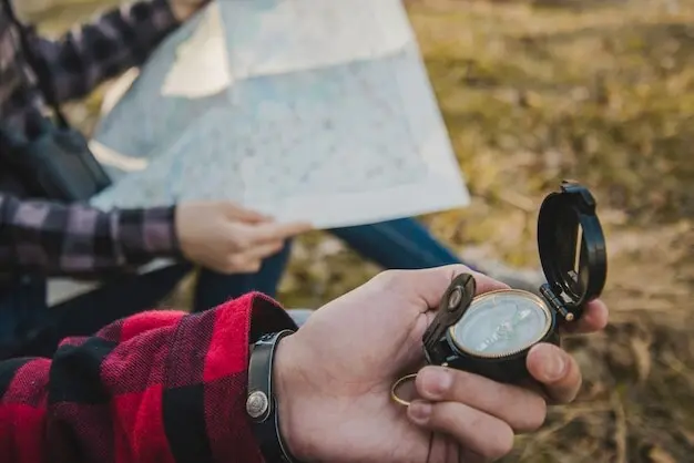
Setting magnetic declination correctly

Adjusting for magnetic declination aligns your compass with map north, preventing creeping errors that grow catastrophic across kilometers of broken terrain. Confirm the current value before departure, set the bezel or note the constant, and verify with a known landmark. Habitual cross-checks at rests reinforce accuracy under fatigue and pressure.

Taking and following a precise bearing in a whiteout

In flat light, pick a close visual cue on the chosen bearing, advance to it, then repeat, minimizing lateral drift. Use a sighting mirror if available, and pair bearings with timing or pacing to monitor progress. Assign a teammate as alignment checker, preserving spacing while preventing the silent arc that wastes hard-won elevation.

Fixing position with resection and triangulation

When uncertainty creeps in, take bearings to two or three distinct features, back-bear them onto the map, and note the intersection. Favor sharp features like spires, cols, or lake corners for precision. Mark your fix, compare expected elevation, and reconcile inconsistencies, building a resilient loop that keeps guesswork out of critical decisions.

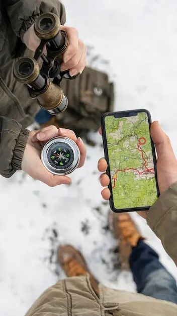
Plan the Journey Before the Weather Plans It for You

Effective preparation turns paper and plastic into real margins for error. Plot checkpoints, pace segments, and bailout lines while warm and rested, then brief everyone until the plan is shared, not secret. Integrate forecast windows, avalanche problems, daylight limits, and realistic energy budgets to ensure aspirations match conditions, capability, and consequence.

On-the-Move Micro-Navigation

Fieldcraft stitches strategy to footsteps. You will pace, time, and read snow texture, while confirming altitude at logical points like benches and saddles. By chunking terrain into small, checkable legs, drift becomes detectable, morale remains steadier, and course corrections happen early, cheaply, and without eroding the group’s precious confidence.

Pacing, timing, and altimeter cross-checks

Calibrate a personal pace count on similar gradients and snow, then track beads or mental tallies between features. Pair minutes per leg with estimated ascent from contours, validating with altimeter readings at known elevations. When numbers disagree, pause, resection if possible, and reset before momentum carries you into consequential, harder-to-correct terrain.

Navigating glaciated terrain and crevasse zones

Map shading suggests glacier flow, but your line must respect seasonal bridges and wind redistribution. Travel roped where appropriate, keep bearings disciplined, and steer for known safe benches or medial moraines as intermediate anchors. Probe suspect zones deliberately, communicate before transitions, and accept detours that trade minutes for meaningful safety margins and calm minds.

Human Factors and Safer Choices

Pre-departure briefings and shared mental models

Walk the group through the route, checkpoints, hazards, and contingencies using the annotated map. Confirm who sets bearings, who times legs, and who monitors weather. Encourage questions now, not later. By distributing responsibility, you reduce blind spots, build alignment, and create a culture where verification is expected, not resented or delayed.

Cognitive traps and tempo control

Beware scarcity of time, social pressure, and summit fixation, which narrow attention and shrink option space. Use checklists to offload memory, stop for deliberate cross-checks, and slow the pace when terrain complexity rises. A few thoughtful minutes often prevent hours of backtracking, preserving energy, daylight, and the group’s trust in the plan.

A real-world near-miss turned learning moment

Crossing a fogged-in plateau, our team drifted imperceptibly toward a corniced edge. A quick bearing check, resection to a distant radio mast, and an altimeter confirmation exposed the arc. We pivoted to a conservative bench, accepted the delay, and reached shelter grateful that quiet discipline trumped urgency and ego that afternoon.

Care, Redundancy, and Trustworthy Tools

Paper lasts when batteries quit. Store maps in waterproof cases, carry a spare, and protect them from wind shredding at transitions. Keep the compass warm, check for bubbles, and verify needle swing. Layer redundancy with altimeter and cautious GPS use, but keep primary navigation anchored to durable, human-centered processes.

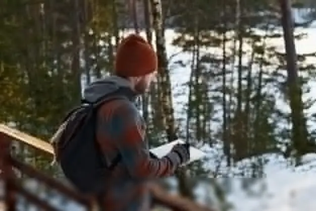
Protecting paper maps and creating custom prints

Laminate field copies or use durable map cases, folding along logical legs for quick access. Mark routes with pencil to allow revisions, and print custom overlays for seasonal hazards. Stash a small spare in a partner’s pack. Organization reduces faffing in storms, protecting both information and group energy when it matters most.

Compass reliability in cold and maintenance

Inspect your compass before trips for bubbles, sluggish needles, and cracked bases. Cold can thicken fluid, so keep it inside a jacket when idle. Verify bearings against a known landmark occasionally. Replace worn lanyards, clean edges for accurate map work, and respect this tiny instrument that safeguards hours of careful planning.

Laxidavonexomexolumavelto
Privacy Overview

This website uses cookies so that we can provide you with the best user experience possible. Cookie information is stored in your browser and performs functions such as recognising you when you return to our website and helping our team to understand which sections of the website you find most interesting and useful.